
We travel north and south every month so are often looking for something new to see or do. In February we took a road less traveled through southeast Utah on our way to Albuquerque and then Mesa. Our first stop was Goblin Valley.

Goblin Valley received lots of media attention a while back when a video surfaced of a scout leader pushing over one of the "goblins."

We drove south of the I70 on a narrow highway rambling over rolling land with very little traffic. Then there was a little hidden canyon unlike any we had ever seen before.
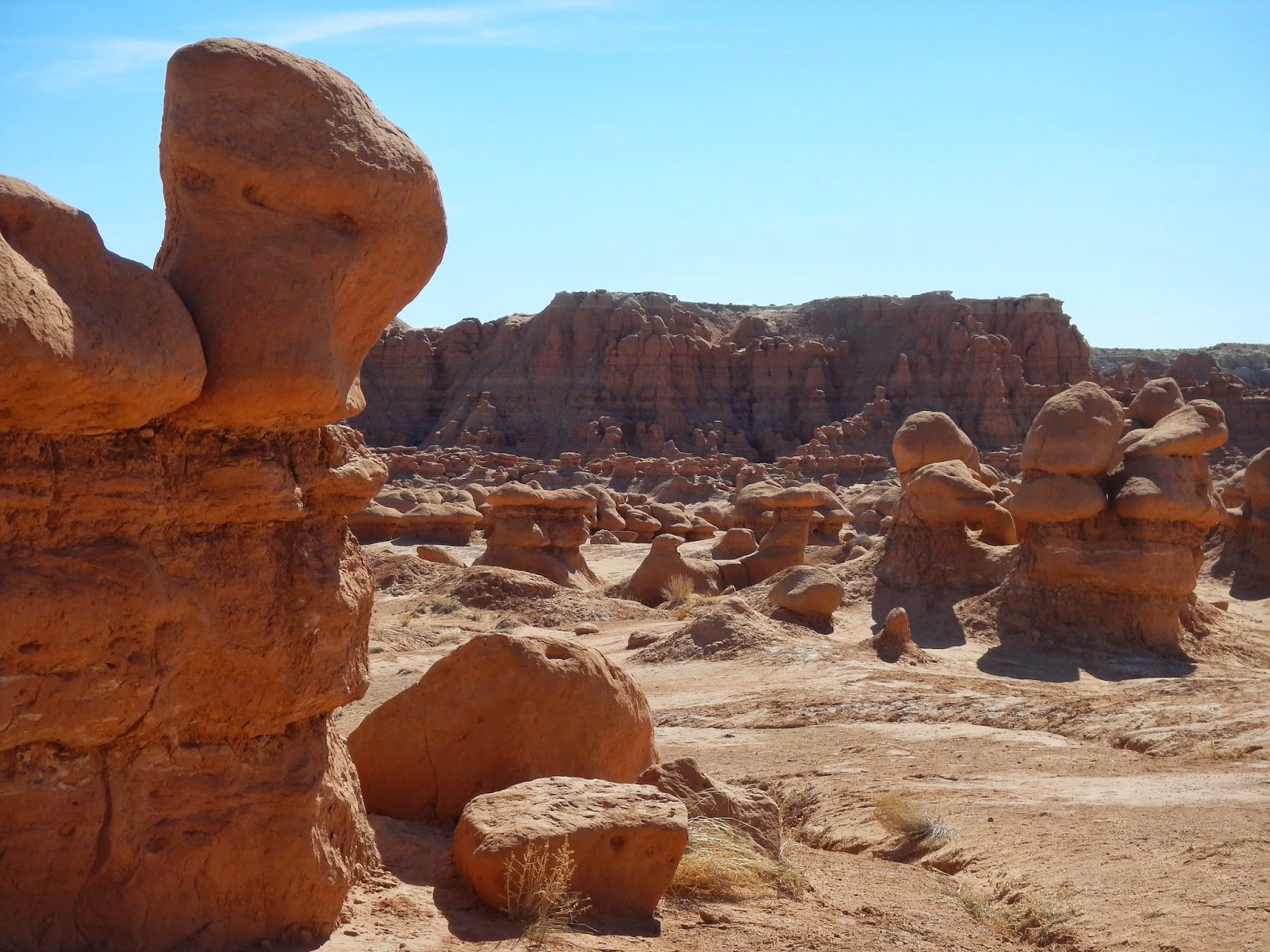
If it was like anything, it might be a very miniature version of Bryce Canyon.

The Henry Mountains glowed in the background to the south.

I have inserted Glen into the pictures to help give a sense of scale. I am standing in the bottom looking up toward the parking lot.

Up close, those "goblins" look pretty big.

It was kind of like cloud watching. We were pointing out "goblin" look alikes.

It is a big valley and once you climb the hill . . .

one finds even more. . .

stretching into the distance.

What you can't see is the video crew who were filming. We tried to stay out of their shot.

Does any formation resemble anyone you know?

The road leading in and back out again passes the guardians know as "The Three Sisters."

They have been standing as sentinels for years and years and years.

This mesa overlooks a nearby campground.

It was very majestic.

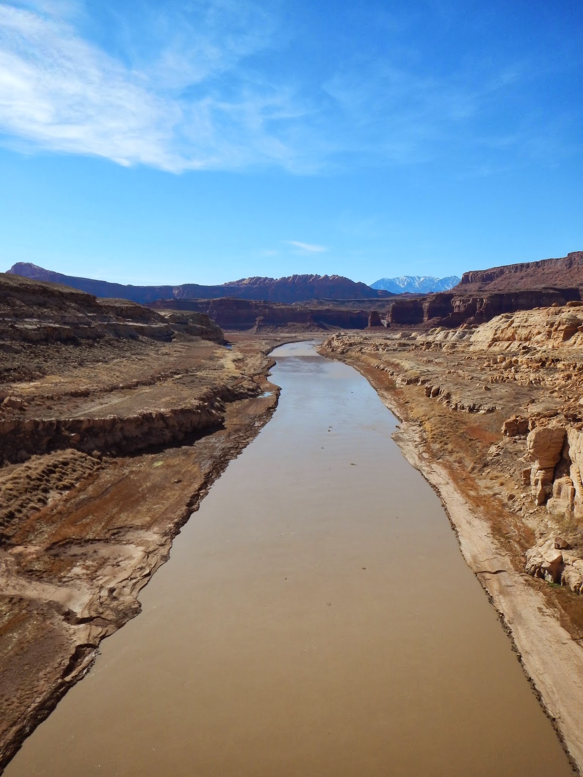
Upon leaving Goblin Valley, we headed south to Hanksville and then turned left finally stopping above Hite's Landing. See that strip of concrete on the upper left side? It used to be the launching ramp for boats at the northern end of Lake Powell. As you can see, the water is long gone. The Colorado River still runs but can't be seen in this shot because it runs at the base of the cliffs we are standing on.

Now I am looking toward the northeast and the river is visible.

At one time this was mining country and a town called Hite was built on the flats by the river.

Once again we are looking at the Henry Mountains which are now to our northwest.

A man and his car. Have you ever noticed how many car ads are filmed near red rocks?

We made our way down the cliff to this span bridge which. . .
crosses the Colorado River. It will be interesting to see how much snow melt there is this year.

We continued south until eventually coming to the Natural Bridges National Park entrance but we chose to take a smaller road to the right and continued south where it eventually turns into a dirt road. We had taken this route, but heading north, years before and Glen wanted to try it again. The road continues to the edge of this cliff and that is Monument Valley in Arizona off in the middle right distance.

We began the 3 miles down a road of switchback after switchback along the side of that cliff. It was pretty thrilling. This view is toward The Valley of the Gods.

Yup! I promise you that I am looking back at the road we just descended right down that cliff face. We continued on to Farmington, New Mexico where we spent the night. We had another adventure planned for the next day.
No comments:
Post a Comment