Thursday, September 21, 2017

Lovely Tetons


The day after the Total Eclipse of the Sun we left our lovely cabin in Island Park and headed back to Utah and home.  We had always planned to go home a way other than the I 15 which would most likely still be crowded with traffic heading south.  Glen had very much wanted to take the Ashton Flagg Ranch Road, a dirt road that takes one across eastern Idaho just south of Yellowstone Park and then comes to a paved road just south of the South Entrance to Yellowstone Park.  It was an interesting drive with lakes covered in lily pads, forested mountain sides, mountain meadows, and unfortunately near the end blackened trees where forest fires had burned not long ago.  One of the things I found most interesting was that once we went over the divide the pine trees were a different variety than those on the west side of the divide.  We stopped at Flagg Ranch for a break and found that many had chosen to watch the eclipse from this location.  We were then back in the car and heading for Grand Teton National Park.


We drove to the top of Signal Mountain for this great view of the Tetons with Jackson Lake in the foreground.


There was a bit of haze in the air due to fires in the west but we still enjoyed our view to the west of the east side of these mountains.  This mountain viewpoint provided a 360 degree view so we also enjoyed the valley views to the east as well.


Our next stop was Jenny Lake on the south end of the range which has always been my favorite lake. 


The clear waters floating right up to mountain edges are striking.


If in a boat, the sounds seem other worldly and the boats dock right up next to the "V" where one can hike up to a beautiful waterfall.


It is one of my best memories of being with my children years ago.


It is not to be missed.  I love the Tetons.  I grew up on a farm on the west side of the Tetons and looked east many a morning to view their stunning outline.


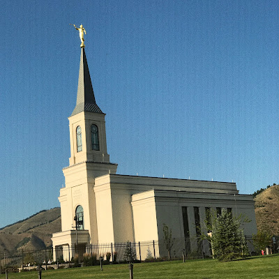
Luckily, there was little traffic until approaching Jackson Hole.  We had lunch/dinner and then headed south along the Snake River, then through Star Valley home of this beautiful temple, and then on through western Wyoming and parts of northeast Utah and then back to Evanston, Wyoming before taking the I 80 back to Utah and then on to Provo Canyon and home.  It was beautiful drive, but dark once in Evanston.  I had forgotten how lovely the western side of Wyoming could be.

Tuesday, September 12, 2017

Great American Solar Eclipse


We were early to rise on Monday morning, August 21, 2017.  We had miles to drive from Island Park to the place we had picked to watch the total solar eclipse.  We left the cabin in what we thought would be plenty of time but as we approached the highway there was already a line of cars that looked like they may have stretched back all the way to West Yellowstone.  Fortunately, everyone was being polite and taking turns letting cars in.  My son started to panic and convinced my husband that we needed to get off the highway and travel the dirt road to the east called Fish Creek Road.


As you can see, this route would take us quite some distance from Highway 20.  My vote was "NO."  I lost and we were soon making a U-turn on the highway to connect to Big Springs road and then the Fish Creek road.  We did have it to ourselves.  Eventually we passed a van full of New Yorkers who were totally amazed that we wanted to pass them and their dust.  We were soon far enough away that they had no dust.  Notice those switchbacks.  That part was pretty fun and eventually we reached black top that was so seldom used there were grasses and flowers growing in the cracks.  Benefit of this route, beautiful wildflowers along the road.

Our son-in-law is not prone to panic  (unlike our son.)  He stayed on the highway and reached our planned destination and meeting point 10 minutes before we did.


We could have both stopped in Ashton but that location farther north would have a minute less of a the grand experience of a total solar eclipse.  Ashton may have been the place of my birth but my first 12 years of life were spent in Sugar City.


Our planned location was the Sugar City Cemetery located south of Sugar City and northeast of Rexburg.  I have many ancestors buried in this cemetery.  I looked forward to showing my grand children their grave markers.  However, the cemetery gates were padlocked as were several other places.  Signs were in place stating that there would be no access between August 16 and 23.  Bottom line, one could not watch the eclipse from every place but fortunately, there were still plenty of places to be.


We just pulled over to the side of the road next to the fence.


Not much traffic so the boys had plenty of room to be eclipse warriors.


At this point, we were already seeing a difference in the light.


And in the shadows of the trees.  When the moon completely covered the sun, we experienced something so wonderful it is hard to even describe it.  I had decided to not worry about taking pictures but to just enjoy my two minutes plus of totality where the sky darkened, the sun solar flares put on their show, planets became visible, and sunset formed all around us.  I will never forget the wonder of it all.

My daughter took this great video of our experience.
 
Total Eclipse of the Sun from the Sugar City Cemetery


Side note:  After the eclipse we took Highway 32 back to Ashton where we got gas and then drove on to Island Park through the Mesa Falls route.  We pulled of the highway and drove into the site of the Teton Dam.  This dam failed on June 6, 1976 flooding miles and miles of land, farms, homes, and towns.  The dam was first breached on the left side of this picture.  Now there is just a large mound of the dam in place in the center of the canyon with openings on both sides.

 
This photo is looking west with the Teton River visible on the right side of the photo. Several fishermen lost their lives will fishing downstream on that day 41 years ago.  It was sobering to see this site again and then to realized how many years had passed since that horrible day.

Sunday, September 10, 2017

Ashton to Tetonia Trail


Back in the early 1900's, railroads were the means of moving people, goods, and harvested crops from place to place.  One such railroad was the one that ran between Ashton and Tetonia for 29 miles in eastern Idaho in the shadow of the Tetons.  Several years ago, the railroad tracks were removed but the railroad bed was left as it was.  Recently it was groomed into a trail for hikers, bicyclists, and snowboarders in the winter time.  One of the trail's charms are the trestles over various creeks which are now refurbished and ready for those wanting an overview of the creek meandering below.


After Mesa Falls we were on our way to experience a part of this trail which passes by the turnoff road going to the ranch where my mother was raised.  That was our first destination but we soon discovered that the trail did not follow the railroad bed at that turnoff as a private owner had not given permission.  You can see the exit from the railroad bed in the upper center of the map. This map was provided next to the sign and someone had marked "you are here."  Apparently, the wrong sign had been installed at this spot.  It was getting late in the day, so we took a very short hike from this sign south.


It was a hot day and a former railroad byway does not have many if any trees.


 Many of the former grain elevators are still in place.  It was later August so harvest was in full swing.


There were several grain elevators located along this 29.5 miles of railroad track.


My brother in law, Lowell, checking to see if it is still in use.


We walked on to the trestle, not tall at all, farther south of the grain elevator.


We saw two bicyclists taking this route.  Since we were much later in the day with dinner still to prepare, Glen reversed course on the hike and brought the car to the end.


My son Ryan and the rest of us agreed that a return trip would be great especially if we hiked to the trestle over Conant Creek which runs through the ranch we all remember with such fondness.

Upper Mesa Falls in Island Park


Once upon a time this building was a lodge for visitors coming to see the beautiful Mesa Falls.  It has been restored to look much as it did back in the day but is now a visitor's center and store.  I love the brown and white.  Just to the west of it are a series of walkways and stairs taking you to vistas of Upper Mesa Falls.


It is a spectacular sight on Henry's Fork River in the southern half of Island Park.


It was a busy day in the park with the total solar eclipse to take place the following day.  There was a a bit of a wait on the main road as cars had to leave before new parking spots were available.


The roar of the Falls was beautiful.


A view of the river down below.


Another smaller drop off.


Mesa Falls from a look out farther down the walkway.


So much flowing water.


Sentinels down below keeping watch over those ripples.


A flowing river racing south to Little Mesa Falls through a beautiful pine forest.


My fellow explorers.


The west side of the river was beautiful and green like a rain forest from all the mist venturing across from the Falls.  This was a lovely stop and view on our way to Ashton and the farm hills east.

Tuesday, September 5, 2017

Big Springs in Island Park, Idaho


Our Idaho trip in August was in the planning stages for months.  Total solar eclipse, check.  Family reunion, check. Place to stay, check.  Things to see, check. Planned menus, check.  Traffic planning, check.


A client of my husband's generously let us stay at his cabin in Island Park for almost a week.  We very much enjoyed exploring and experiencing Island Park again.  One of my favorite places is Big Springs where 126 million gallons of water come up out of the ground EVERY day creating the beautiful Henry's Fork River.


How is that possible you may ask?  This sign and diagram explain it all.


Just look at that beautiful river which has formed on the other side of the bridge.  It is clear and dazzling and full of fish.  A few miles downstream there is a spot to launch one's water craft for a beautiful ride.


Look closely.  Can you see Johnny Sack's handmade cabin back under the trees?


Johnny began making this beautiful little home by hand in 1929.  His family had immigrated from Bavarian Germany so his home had a bit of Bavarian charm.  He, himself, was just under five feet tall.  Everything is pretty much just how he left it including this cozy kitchen.


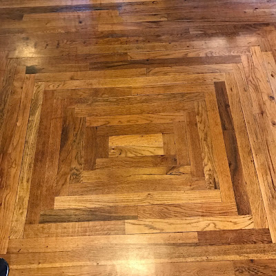
The floors were beautiful with each piece of wood carefully set.


This is a painted wood carving of Johnny which is found on the front porch.


Two bedrooms are on the second floor.


Both beds were covered with beautiful quilts.


A colorful painting based on a black and white photo of Johnny and his dog.


He read Zane Grey novels  just like my husband and my parents did with their families before radio and TV.


This special place has been made an Historic Place.


There was a special house up on the hill.


Johnny painted the outside to honor his desire for a Bavarian look.


This second little cabin down the hill has its own water wheel creating power for the cabin.  It is a beautiful place.